
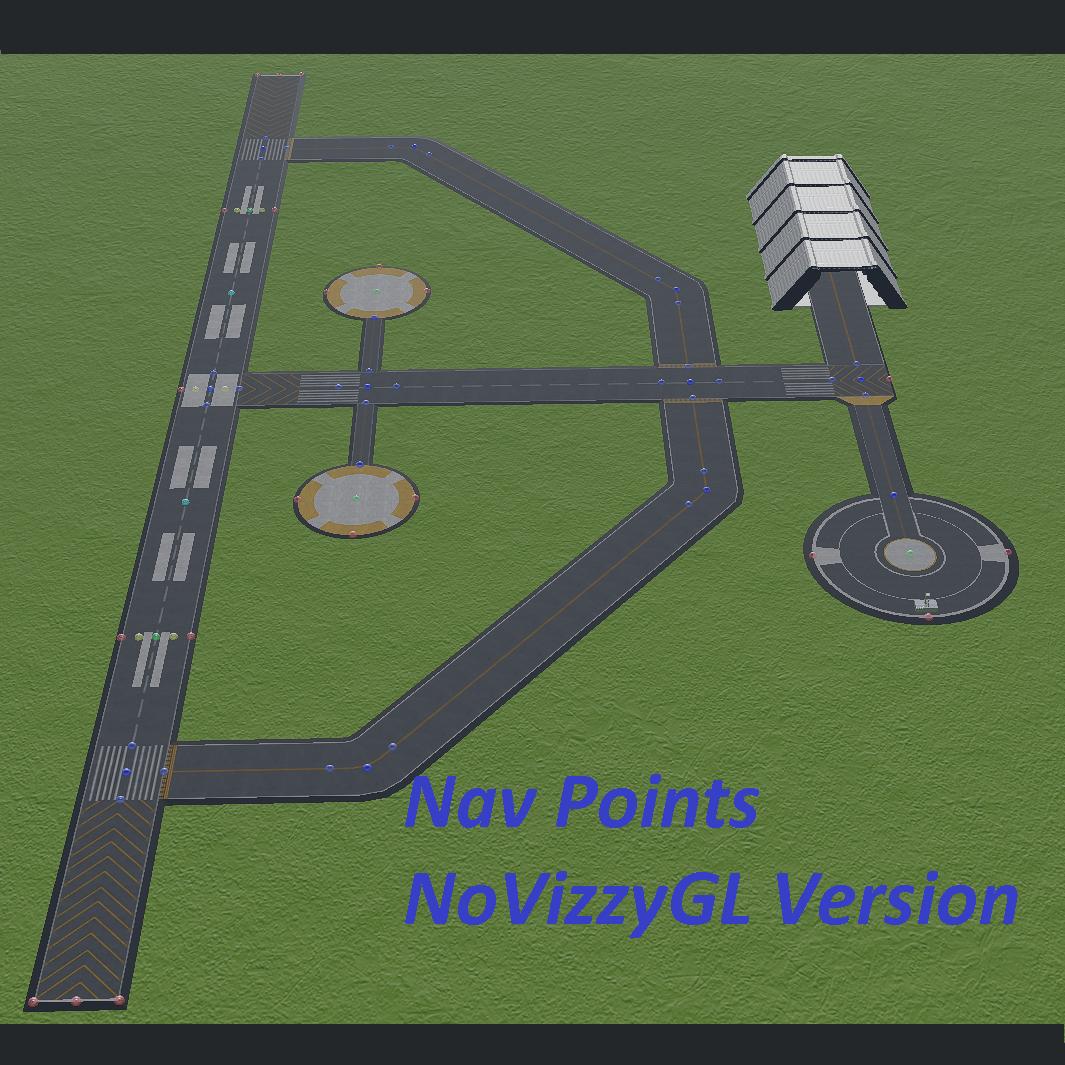
Nav Points in vizzy
Have VizzyGL? Want the latest version where you can identify all the points with Slider 1?
CLICK HERE
Hello! Welcome to the forum post that accompanies the following craft link:
Craft link
What is this, what does it do?
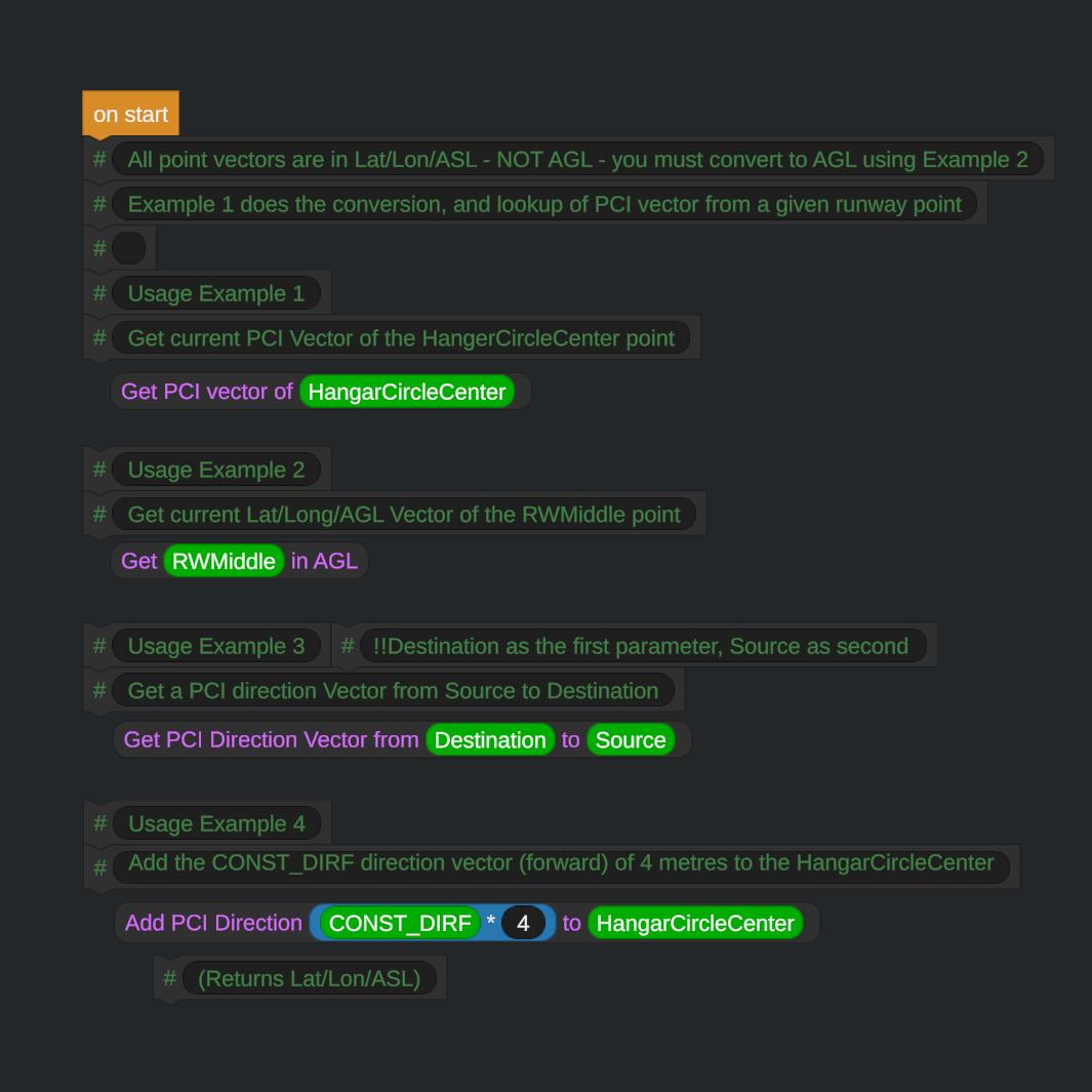
Simply put, this is a flight program (distributed via a craft file) that you can save, and then import into your own crafts flight programs. It will pre-create a set of variables, matching the green, blue, and red names shown in the images below.
These variables can be used in your own scripts to aid into crafting automated movements at the launch complex (be it for rockets, planes, or anything!)
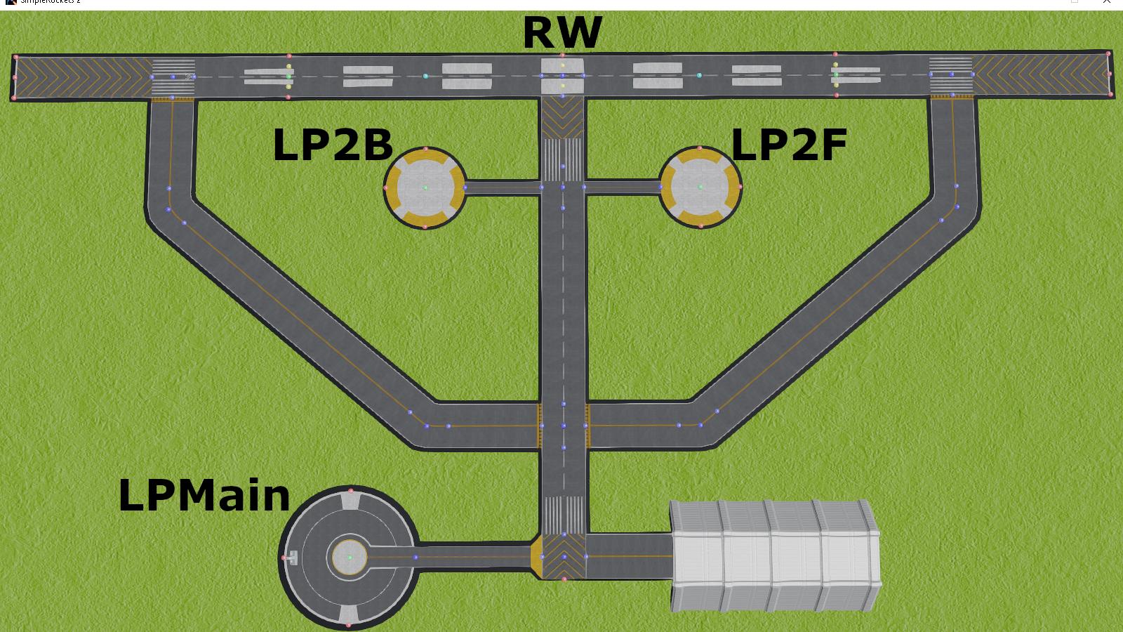
Main Location Reference Names (informative)
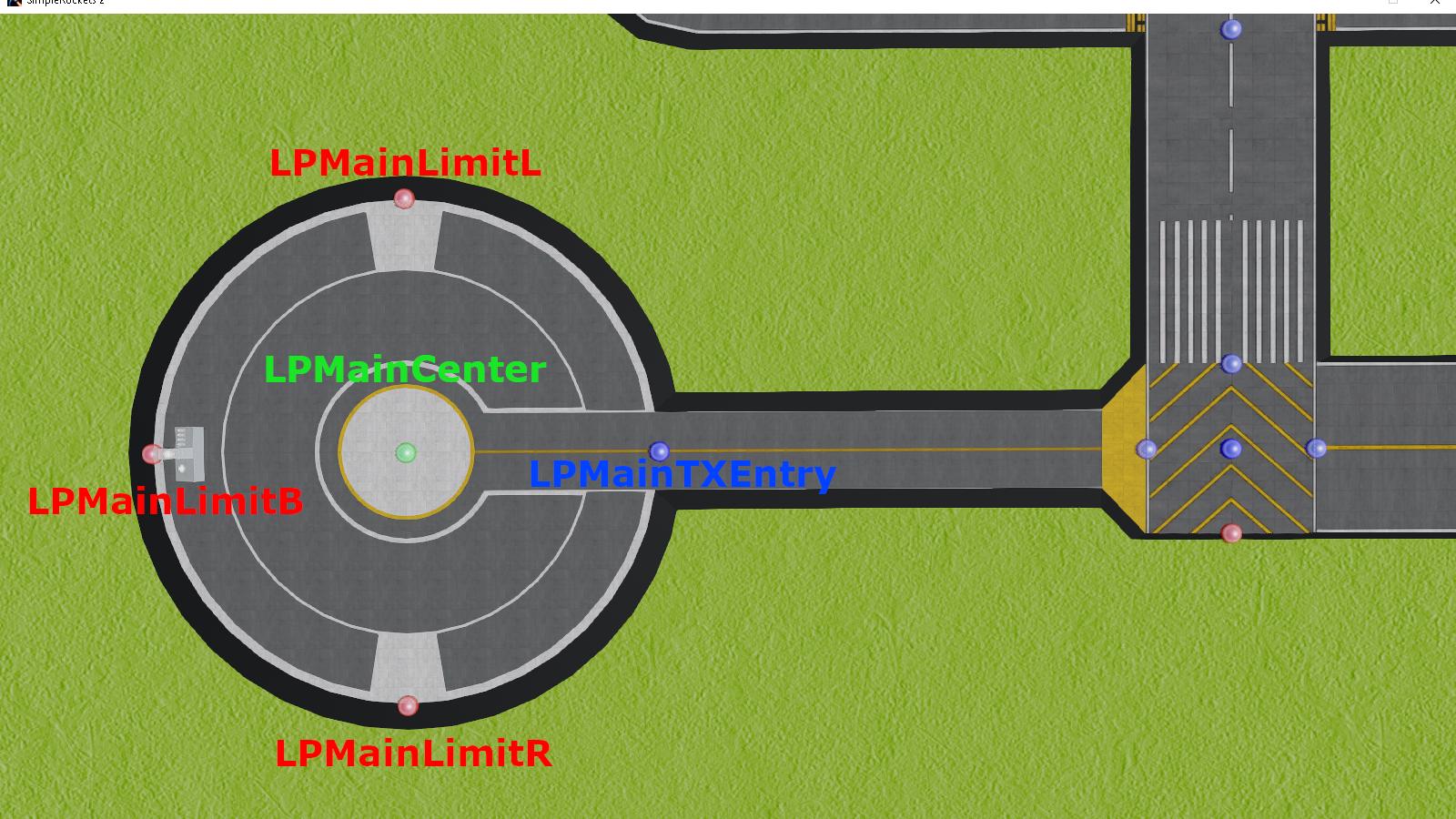
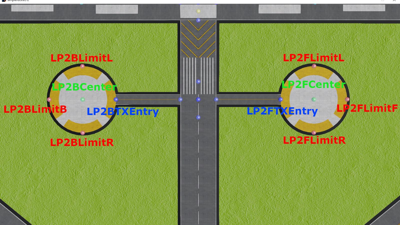
Actual RWPoint variable names (Main, and secondary launch pads)
To facilitate usage, some custom expressions are included, and can be seen in action in the examples:


I wanted to upvote your program but I voted too much I will return here and give you my promised upvote point, because you deserve this very much. This program is very very very (did I mention... VERY...) useful, because I am looking for a very long time for a gps guided system, that can be rolled out on any planet, so that you can use this system on your ATV, rover, that you can find home and whereever you want to go. For instance you need a test parcours for rovers to examine which one has the best configuration, which one will lose this contest, and you can make a better suspension on your car for other planets. It does not make sense to make anything with anything, you have to check first at Droo, before you make a high cost sensible working fright to Brigo e.g. e.g. e.g. .... so I may say thank you to your interesting project, maybe this helps my gps program for vehicles