
ENABLING THE NEXT GENERATION OF GPS NAVIGATION
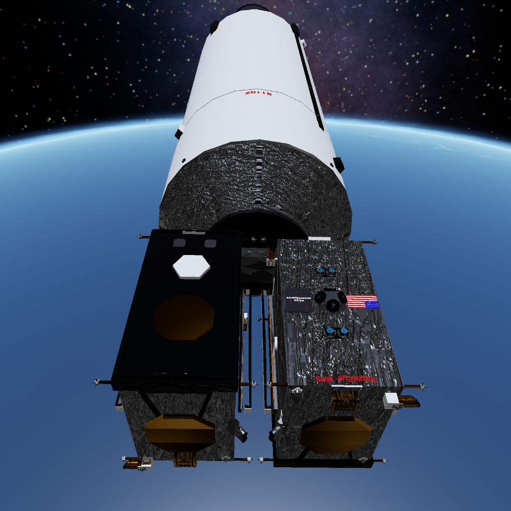
EagleEye GPS is a high-end commercial GPS navigation platform, manufactured and operated by Orion Technologies. Built to replace the aging USSF GPS constellation, these satellites bring in the new era of navigation. Utilizing ultra-high precision sensors, coupled with laser alignment technology, EagleEye GPS is available to both government and commercial entities. Our soon-to-be 24-strong constellation will provide the entire world with advanced GPS navigation technology, even in the most remote places. Launched two-by-two on our Eagle 5 Partially Reusable to MEO, we will soon be operating the world’s premier Global Positioning System.
DESIGN OVERVIEW
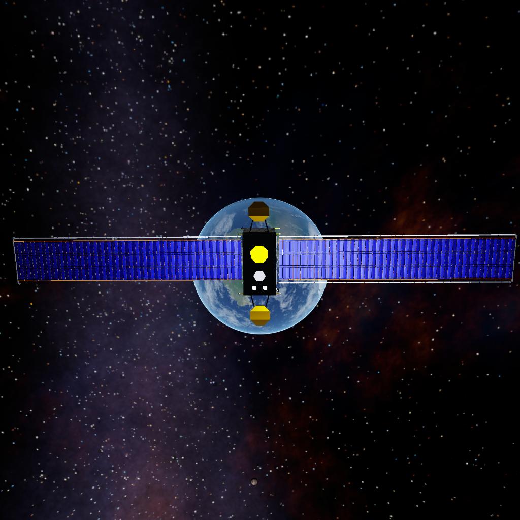
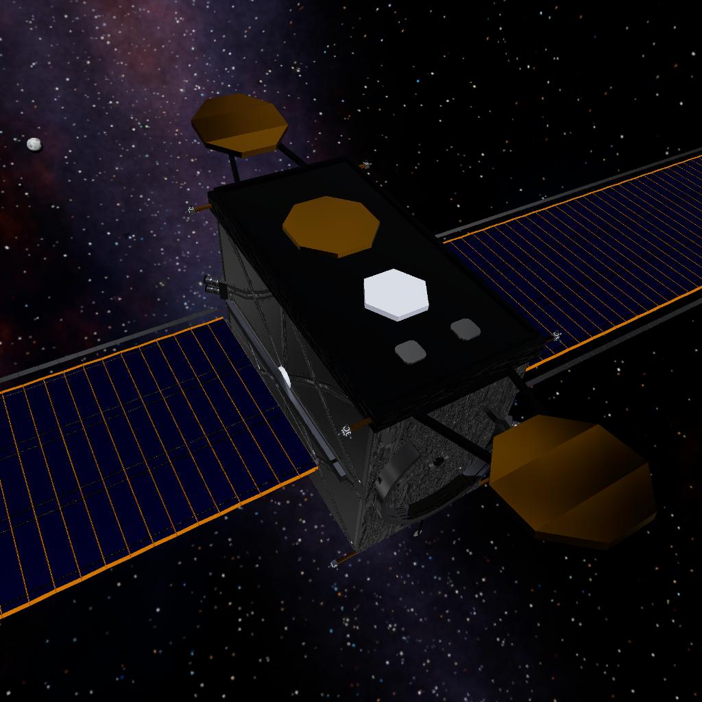
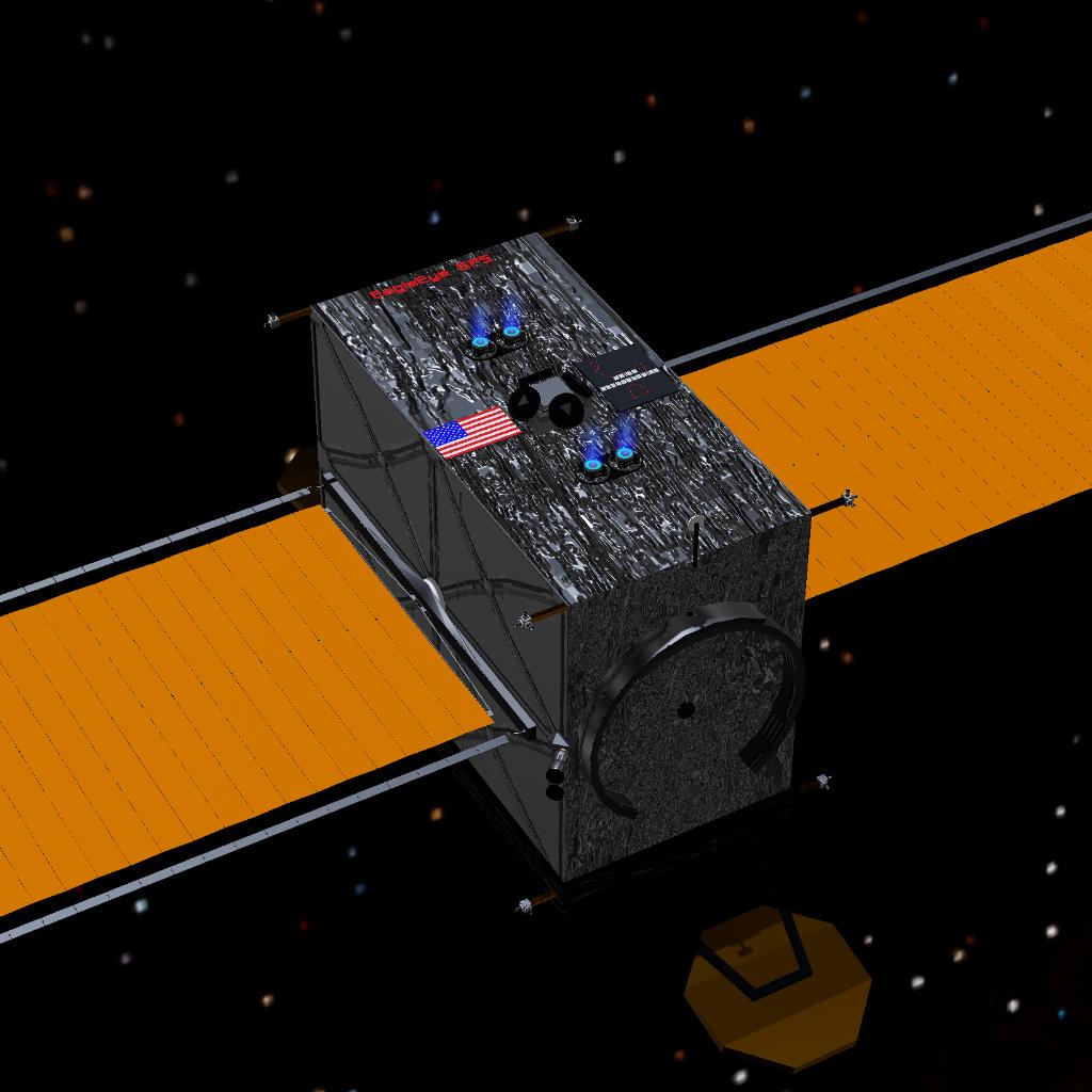
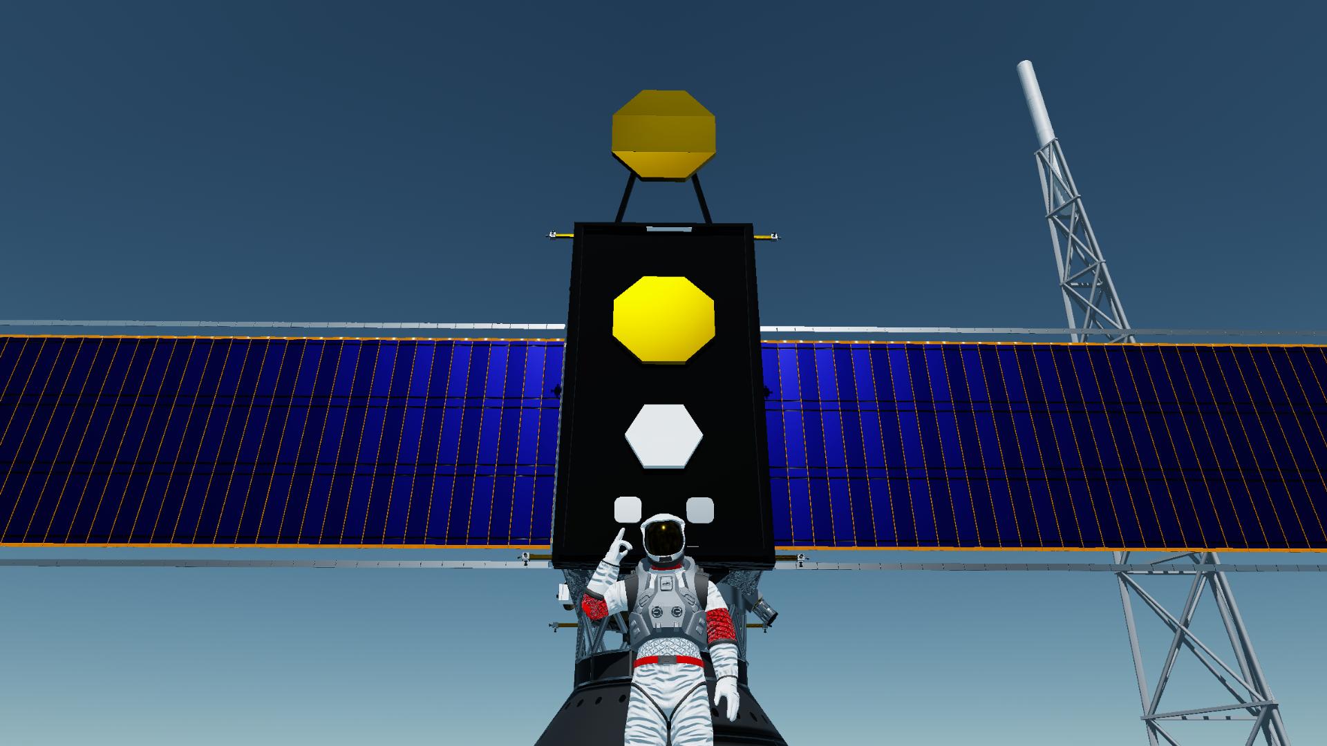
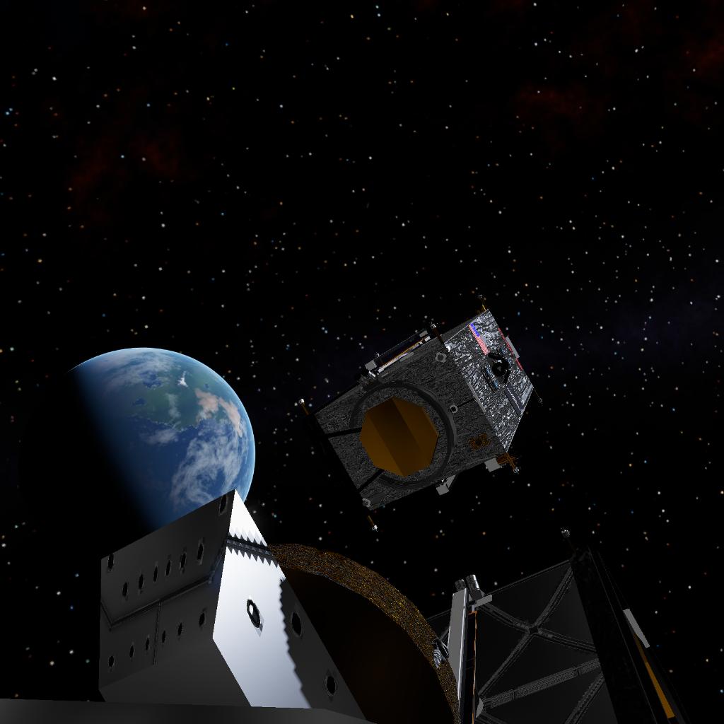
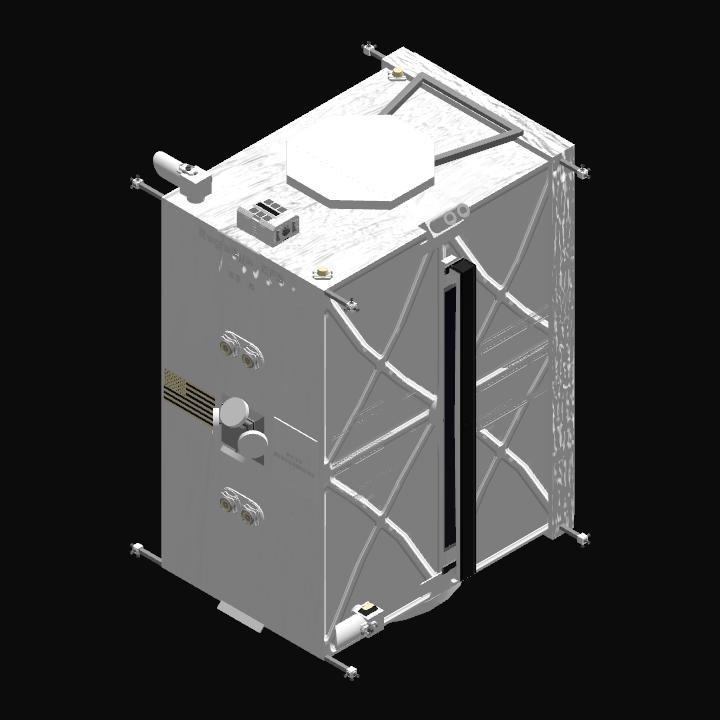
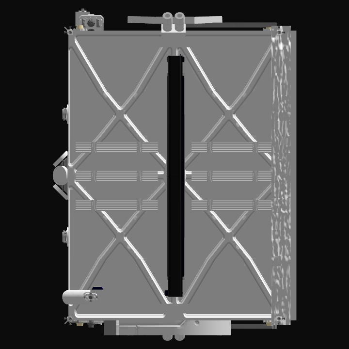
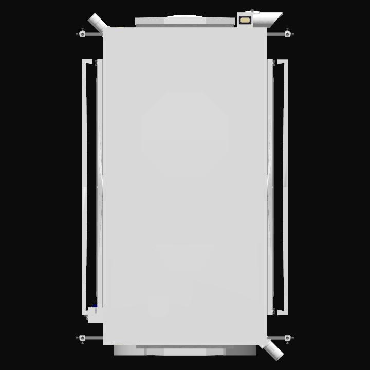
EagleEye GPS Block I satellites consist of a rectangular prism spacecraft bus, 10ft x 7ft x 5ft. The bus holds all necessary avionics, batteries, radiators, GPS equipment, navigation systems, and fuel, approximately 1.4 tons of hydrazine and 200kg of xenon. Two ROSAs(Roll-Out Solar Array) power the spacecraft in whole. 4 stationary and 2 deployable GPS antennas fulfill the satellite’s mission. A set of advanced laser sensors allow for extremely-accurate GPS antenna pointing. 4 HETs(Hall-Effect Thrusters) aid in long-life station keeping and end-of-life disposal. An array of precise RCS thrusters allow for faster orbital adjustments. Additionally, a pair of OISL(Optical Infrared Space Laser) terminals allow for inter-constellation communication. Two satellites can be launched at once onboard the Eagle 5 Partially Reusable launch vehicle into MEO, approximately 6000km x 6000km. 5 orbital planes are planned for the eventual constellation of 24 navigation satellites. The first two satellites were launched at 4:49AM UTC, May 18 2025.
INSTRUCTIONS FOR USE
AG1: Satellite Deploy
AG2: Hall-Effect Thrusters
AG8: RCS
AG9: ROSA Deploy
AG10: Lights
Slider 1 for ROSA rotation. Automatic solar tracking is not available.
Launch into 6000km x 6000km orbit, deploy AG1, AG9, and AG10. Place satellite in a prograde attitude, and orient such that the black face and gold antennas face towards Earth. Activate AG2 for end-of-life disposal. Enjoy!
ACKNOWLEDGEMENTS
Credit for the original ROSAs goes to @GreenGalaxyAeroSpace, though I heavily modified them.
GENERAL INFO
- Created On: iOS
- Game Version: 1.3.204.1
- Price: $5,398k
- Number of Parts: 180
- Dimensions: 3 m x 2 m x 3 m
PERFORMANCE
- Total Delta V: 2.2km/s
- Total Thrust: 24N
- Engines: 4
- Wet Mass: 4,423kg
- Dry Mass: 2,829kg
STAGES
| Stage | Engines | Delta V | Thrust | Burn | Mass |
|---|---|---|---|---|---|
| 1 | 4 | 2.2km/s | 24N | 4.61days | 4,423kg |
12 Comments
- Log in to leave a comment
-
4,222 KuiperTechnologies9 months ago
@ASXJNO, okay, you can do the 4, one per launch vehicle(weight limits). Good luck,
-
562 ASXJNO9 months ago
@OrionTechnologies one rocket can do 2,200kg to MEO and the other can do 4,300kg to MEO
-
4,222 KuiperTechnologies9 months ago
@ASXJNO, what are launch vehicle specs? If they fit the requirements, then you can do 4 satellites.
-
-
4,222 KuiperTechnologies9 months ago
@QuantumSpaceJNO, can I do a quick Launch Vehicle Payload Estimate for your Quantum Omega 3? I’ll need a few numbers:
Height of launch vehicle
Number of Stages
Diameter of all stages
Fuel of all stages
Number of engines for all stages
Cycle for all engines on all stages
Strap-ons(if any)
Reusability of all stages
Once I have these numbers, I can put them into an algorithm and get a very reasonable estimate of payload to LEO, and with some simple math, the payload to MEO. -
4,222 KuiperTechnologies9 months ago
@QuantumSpaceJNO, okay, is there any way to get that up to 4 tonnes to MEO?
-
12.5k AAstronomy9 months ago
@OrionTechnologies the payload amount it wrong. I estimate its about 4 tons to leo
-
4,222 KuiperTechnologies9 months ago
@QuantumSpaceJNO, okay, we consent to you launching one(1) EagleEye GPS Block 1 satellite into a MEO, under the specified parameters. However, we noticed that the estimated payload for Quantum Omega 3 is 1 ton(I assume metric), just to LEO. A single EagleEye GPS satellite weighs in at over 4 metric tonnes, so we are concerned towards this. Are you sure that this number is correct? If so, then we are going to decline an EagleEye GPS Block 1 being onboard.
-
12.5k AAstronomy9 months ago
@OrionTechnologies
faring is 5 meters wide
launch can carry 1 ton to LEO
no other payloads in as of now so N/A
Confidence for sucess 7/10 -
4,222 KuiperTechnologies9 months ago
@QuantumSpaceJNO, we’ll need some numbers first to validate its capabilities:
PLF diameter/height
Launch Vehicle Payload to LEO
Weight of other payloads
Confidence Level(0-10)
Cost(if any)
Satellite(s) will need to be sent to a 6000km x 6000km orbit.
Will need to acknowledge this as a collaboration between us as these satellites are very valuable. If we do go ahead with this, will need you to launch a specific unit(s), so don’t use the one from this post. -
12.5k AAstronomy9 months ago
could we possibly launch this on quantum omega block 3's test flight (rideshare)?


@OrionTechnologies thanks