

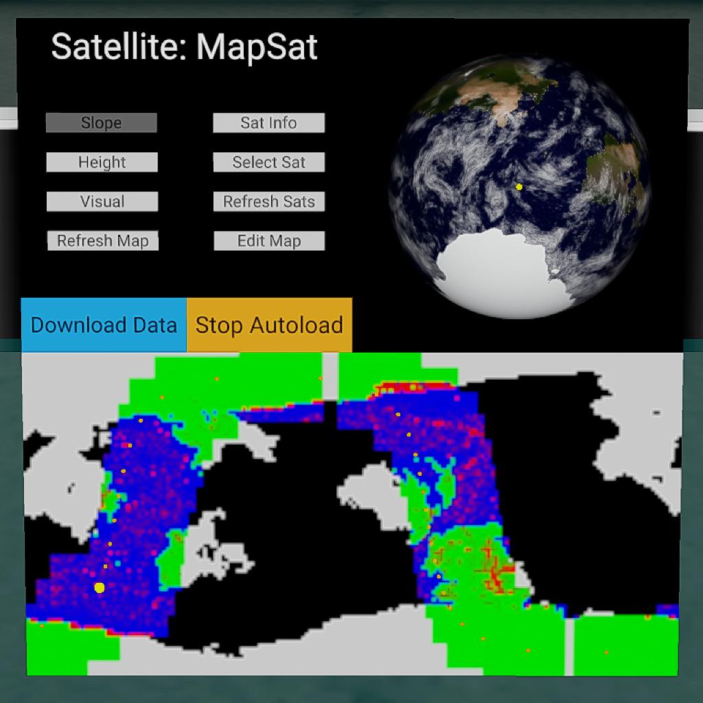


This is a MFD built to use a satellite in orbit to update a base map of Droo. The MFD will detect satellites in orbit with 'Map' in the name (This can be edited to a custom string with a variable found in the program), and display the orbit of the selected sat on a equirectangular map.
The Mapper
The MFD has 3 mapping modes. These are a slope map, a height map and a basic visual map. Each map has a group of settings that can be edited to give different results. The MFD will by default also map underwater terrain, which can be turned off with 'Edit Map'. Basic information about the satellite used for mapping is displayed, and the selected satellite may also be changed.
The Slope Map
The slope map will get the average slope at a pixel's position, with red being the steepest slope, and green the gentlest slope on land, blue the gentlest slope on water. The slope that is displayed as pure red, and the size of the square around the point of land used to calculate can be edited with 'Edit Map'
The Elevation Map
The height map will display height with black being the lowest and white the highest. The lowest elevation given the white value, and the colour given to 0m ASL, can both be changed with 'Edit Map'.
The Visual Map
A basic map showing the colours of the terrain shaded with elevation. The colour intensity given to 0m ASL and the height of maximum colour intensity may also be edited.
Note: Several more options can be edited using variables present within the Vizzy, such as map resolution and the satellite path resolution. The MFD has been edited to allow for a horizontal resolution of 360 pixels.
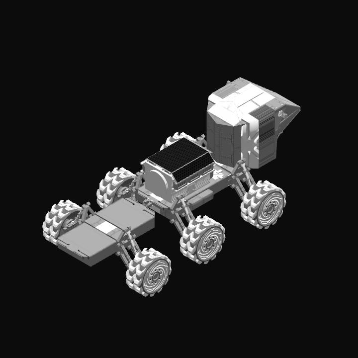
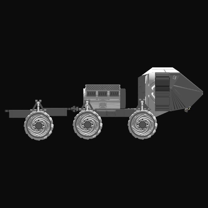
GENERAL INFO
- Created On: Windows
- Game Version: 0.9.704.0
- Price: $8,684k
- Number of Parts: 279
- Dimensions: 4 m x 4 m x 10 m
PERFORMANCE
- Total Delta V: 0m/s
- Total Thrust: 300N
- Engines: 1
- Wet Mass: 8,152kg
- Dry Mass: 4,153kg
STAGES
| Stage | Engines | Delta V | Thrust | Burn | Mass |
|---|

12 Comments
- Log in to leave a comment
-
3,733 QarabinaKaone year ago
@finalfrontierareospace
There's a better version that I made some time ago. Check my profile for MFD GIS. -
-
-
3,733 QarabinaKa4.2 years ago
@NotVedhaspace
Working on that already. I need to work out a less intensive way of doing the calculations though. -
13.8k Vedhaspace4.2 years ago
@QarabinaKa and my suggestion is if it's in orbit it can show the orbit lines
It can be toggled on and offlike this
-
3,733 QarabinaKa4.2 years ago
@NotVedhaspace
I am working on a completely overhauled version of this now. Aiming to give the new version an accurate shape update on the map. -
-
735 Amirabadi4.6 years ago
i cant see sattelites in mfd how to make satelite that it can be shown in mfd
-
-
3,733 QarabinaKa4.6 years ago
@ARXSPACE
If you're talking about the initial map loading, cannot get around it. If you want satellites that can cover large areas of ground, go with a polar orbit -
3,715 Reyzx4.6 years ago
How can I speed up the map loading?
For me,it took like 40 years to upload😂
with a cluster in equitorial orbit and another cluster of satellite in a 60°....
Could you suggest any ideal type of orbit for better map loading?


I love that I can use existing satellites and space stations, super slick system